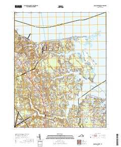
2019 Map of Poquoson West
USGS Topo · Published 2019About this map
The Colonial National Historical Park and the Yorktown Fuel Depot dominate the northwestern landscape of this coastal Virginia region. The intricate shoreline along the York River and Poquoson River is defined by numerous points and necks, such as Calthrop Neck and Hunts Neck, illustrating the deep integration of maritime life with local geography. Residential growth is evident in established communities like Poquoson and Grafton, alongside smaller developments including Evergreen Shores and Piney Point Estates.
Find a feature on this map
76 named features on this map. Tap any name to fly to it.
Don’t see what you’re looking for? This feature index may not catch every label — zoom into the map to look around manually.
Map Details
Editions of this 2019 Poquoson West Map
This is the sole edition of this map. No revisions or reprints were ever made.
Other maps of this area

1906 · Williamsburg
USGS Topo · 1:62,500

1907 · Yorktown
USGS Topo · 1:62,500

1907 · Hampton
USGS Topo · 1:62,500

1916 · Mathews
USGS Topo · 1:62,500

1917 · Mathews
USGS Topo · 1:62,500

1943 · Yorktown
USGS Topo · 1:62,500

1943 · Richmond
USGS Topo · 1:250,000

1944 · Hampton
USGS Topo · 1:24,000

1944 · Yorktown
USGS Topo · 1:24,000

1944 · Messick
USGS Topo · 1:24,000