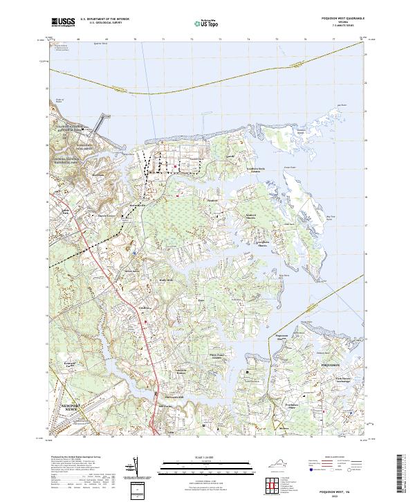
2022 Map of Poquoson West
USGS Topo · Published 2022About this map
Colonial National Historical Park and the Yorktown Fuel Depot dominate the northwestern reaches of this coastal landscape, where the York River meets the western edge of the Chesapeake Bay. The terrain is defined by the intricate finger-like peninsulas of the Virginia Tidewater, including Goodwin Neck, Crab Neck, and Hunts Neck, separated by tidal inlets like Back Creek and the Poquoson River. Residential growth is evident in established communities such as Grafton, Tabb, and Seaford, which sit alongside historic family landmarks like the Hopson Gravesite and Smith Cem. To the east, the protected marshes of Plum Tree Island National Wildlife Refuge preserve the shoreline as it transitions toward Poquoson, while the Virginia Institute of Marine Science at Quarter Point marks the area's continued connection to maritime research.
Find a feature on this map
98 named features on this map. Tap any name to fly to it.
Don’t see what you’re looking for? This feature index may not catch every label — zoom into the map to look around manually.
Map Details
Editions of this 2022 Poquoson West Map
This is the sole edition of this map. No revisions or reprints were ever made.
Other maps of this area

1906 · Williamsburg
USGS Topo · 1:62,500

1907 · Yorktown
USGS Topo · 1:62,500

1907 · Hampton
USGS Topo · 1:62,500

1916 · Mathews
USGS Topo · 1:62,500

1917 · Mathews
USGS Topo · 1:62,500

1943 · Yorktown
USGS Topo · 1:62,500

1943 · Richmond
USGS Topo · 1:250,000

1944 · Hampton
USGS Topo · 1:24,000

1944 · Yorktown
USGS Topo · 1:24,000

1944 · Messick
USGS Topo · 1:24,000