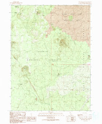
1990 Map of Porcupine Butte
USGS Topo · Published 1990About this map
Burnt Lava Flow Geological Area dominates the northern reaches of this Siskiyou County landscape, revealing a volcanic terrain marked by numerous craters and subterranean formations. Volcanic activity has shaped the local geography, evident in features such as Double Hole Crater and Deep Crater. Below the surface, the presence of the Deep Ice Caves and the Jot Dean Ice Cave suggests a unique geothermal and climatic environment where ice persists within basaltic structures.
Find a feature on this map
18 named features on this map. Tap any name to fly to it.
Don’t see what you’re looking for? This feature index may not catch every label — zoom into the map to look around manually.
Map Details
Editions of this 1990 Porcupine Butte Map
This is the sole edition of this map. No revisions or reprints were ever made.
Other maps of this area

1886 · Modoc Lava Bed
USGS Topo · 1:250,000

1892 · Modoc Lava-Bed
USGS Topo · 1:250,000

1932 · Bartle
USGS Topo · 1:96,000

1939 · Bartle
USGS Topo · 1:125,000

1952 · Timber Mountain
USGS Topo · 1:62,500

1952 · Medicine Lake
USGS Topo · 1:62,500

1954 · Alturas
USGS Topo · 1:250,000

1958 · Alturas
USGS Topo · 1:250,000

1961 · Hambone
USGS Topo · 1:62,500

1962 · Alturas
USGS Topo · 1:250,000