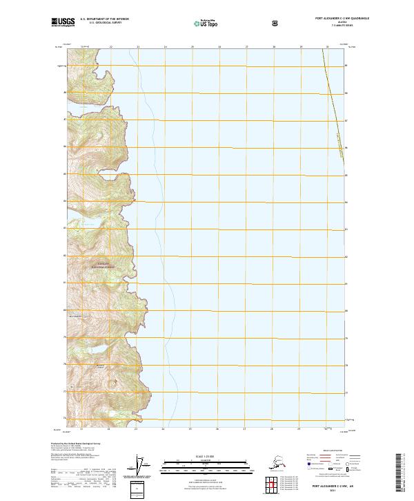
2021 Map of Port Alexander C-2 NW
USGS Topo · Published 2021About this map
Baranof Island presents a sharp vertical landscape where the peaks of the Alexander Archipelago meet the Pacific waters of Southeast Alaska. This 2021 topographic record of the Tongass National Forest highlights the dramatic elevation changes characteristic of the Sitka City and Borough region. Notable summits such as Mt Elizabeth and Mt Cec dominate the coastal interior, their steep contours descending rapidly toward the fractured shoreline. The map documents the intricate hydrography of the coast, specifically where the inlet at Gut Bay carves into the island mass. High-altitude water bodies like Yermak Lake are captured here, providing a clear view of the glacial and geological forces that continue to shape this portion of the Alaskan panhandle. The land remains largely defined by its natural topography rather than human infrastructure, emphasizing the wild character of the state’s forest reserves.
Find a feature on this map
10 named features on this map. Tap any name to fly to it.
Don’t see what you’re looking for? This feature index may not catch every label — zoom into the map to look around manually.
Map Details
Editions of this 2021 Port Alexander C-2 NW Map
This is the sole edition of this map. No revisions or reprints were ever made.
Other maps of this area

1951 · Port Alexander C-2
USGS Topo · 1:63,360

1951 · Port Alexander C-3
USGS Topo · 1:63,360

1951 · Port Alexander D-3
USGS Topo · 1:63,360

1951 · Port Alexander
USGS Topo · 1:250,000

1951 · Port Alexander D-2
USGS Topo · 1:63,360

1952 · Port Alexander
USGS Topo · 1:250,000

1964 · Port Alexander
USGS Topo · 1:250,000

1994 · Port Alexander C-3
USGS Topo · 1:63,360
1995 · Port Alexander D-3
USGS Topo · 1:63,360
1995 · Port Alexander D-2
USGS Topo · 1:63,360