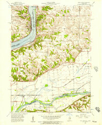
1953 Map of Port Byron
USGS Topo · Published 1957About this map
The Mississippi River serves as the central artery of this mid-century survey, dividing the riverside towns of Le Claire in Iowa and Port Byron in Illinois. The landscape is characterized by a dense network of rural infrastructure, featuring a notable concentration of country schools such as Leafy Bower School and Rose Hill School that once served the agricultural uplands. To the south, the Rock River meanders toward its confluence, bordering the settlements of Barstow and Cleveland. Transportation patterns are well-defined by the Chicago Milwaukee St Paul and Pacific and Chicago Burlington and Quincy railroads, which facilitated the movement of goods through the river valley. Genealogists will find a wealth of data in the many small burial grounds and parish sites, including St Johns Cemetery and Zion Church, documenting the early families who established these communities across Zuma and Hampton townships.
Find a feature on this map
45 named features on this map. Tap any name to fly to it.
Don’t see what you’re looking for? This feature index may not catch every label — zoom into the map to look around manually.
Map Details
Editions of this 1953 Port Byron Map
Other maps of this area

1892 · Leclaire
USGS Topo · 1:62,500

1893 · Leclaire
USGS Topo · 1:62,500

1899 · Clinton
USGS Topo · 1:125,000

1934 · Geneseo
USGS Topo · 1:62,500

1937 · Orion
USGS Topo · 1:62,500

1949 · Coal Valley
USGS Topo · 1:24,000

1949 · Silvis
USGS Topo · 1:24,000

1949 · Port Byron
USGS Topo · 1:24,000

1950 · Port Byron
USGS Topo · 1:24,000

1952 · Erie
USGS Topo · 1:62,500