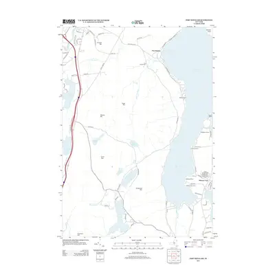
2013 Map of Port Douglass
USGS Topo · Published 2013About this map
The Ausable River flows into the northwestern corner of this territory, where the Adirondacks meet the western shore of Lake Champlain. This coastal landscape is defined by its deep bays and rocky points, from the sheltering arc of Corlaer Bay down to the residential finger of Willsboro Point. The terrain rises sharply from the water toward interior peaks like Prospect Mtn and Rattlesnake Mtn, creating a dramatic transition between the lakeside communities and the high wooded ridges.
Find a feature on this map
84 named features on this map. Tap any name to fly to it.
Don’t see what you’re looking for? This feature index may not catch every label — zoom into the map to look around manually.
Map Details
Editions of this 2013 Port Douglass Map
This is the sole edition of this map. No revisions or reprints were ever made.
Other maps of this area

1894 · Plattsburg
USGS Topo · 1:62,500

1895 · Willsboro
USGS Topo · 1:62,500

1895 · Ausable
USGS Topo · 1:62,500

1903 · Ausable
USGS Topo · 1:62,500

1906 · Plattsburg
USGS Topo · 1:62,500

1913 · Dannemora
USGS Topo · 1:62,500

1939 · Plattsburg
USGS Topo · 1:62,500

1941 · Plattsburg
USGS Topo · 1:62,500

1941 · Willsboro
USGS Topo · 1:62,500

1943 · Willsboro
USGS Topo · 1:62,500