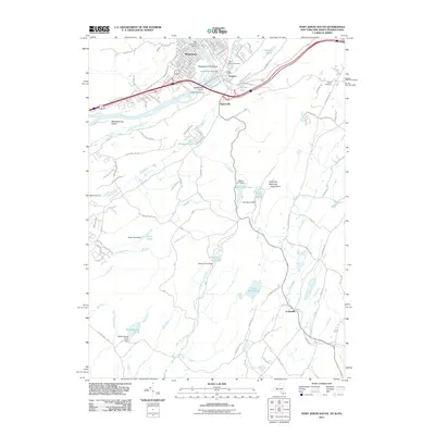
2011 Map of Port Jervis South
USGS Topo · Published 2011About this map
The Delaware River and Neversink River converge at the tri-state border of New Jersey, New York, and Pennsylvania, creating a complex landscape of riverine islands and dramatic overlooks. In this 2011 survey, the Delaware River Gorge cuts past Matamoras and Carpenters Point, where the Mid-Delaware Bridge links these communities across the water. The map shows a high level of detail in the established neighborhoods of Tristates and Duttonville, alongside significant local heritage sites like Saint Marys Cemetery and Laurel Grove Cemetery.
Find a feature on this map
130 named features on this map. Tap any name to fly to it.
Don’t see what you’re looking for? This feature index may not catch every label — zoom into the map to look around manually.
Map Details
Editions of this 2011 Port Jervis South Map
This is the sole edition of this map. No revisions or reprints were ever made.
Other maps of this area

1888 · Franklin
USGS Topo · 1:62,500

1891 · Wallpack
USGS Topo · 1:62,500

1893 · Wallpack
USGS Topo · 1:62,500

1894 · Franklin
USGS Topo · 1:62,500

1897 · Franklin
USGS Topo · 1:62,500

1903 · Franklin Furnace
USGS Topo · 1:62,500

1906 · Port Jervis
USGS Topo · 1:62,500

1908 · Port Jervis
USGS Topo · 1:62,500

1913 · Milford
USGS Topo · 1:62,500

1915 · Milford
USGS Topo · 1:62,500