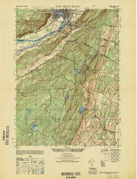
1949 Map of Port Jervis South
USGS Topo · Published 1949About this map
The Delaware River carves a path through this Tri-State region in the late 1940s, defining the meeting point of New York, Pennsylvania, and New Jersey. The industrial and transit hub of Port Jervis dominates the northern edge of the sheet, while the nearby settlement of Tristates marks the confluence with the Neversink River. This survey captures the area just before significant mid-century changes, showing local infrastructure like the Matamoras Airport and the Port Jervis Golf Club.
Find a feature on this map
40 named features on this map. Tap any name to fly to it.
Don’t see what you’re looking for? This feature index may not catch every label — zoom into the map to look around manually.
Map Details
Editions of this 1949 Port Jervis South Map
This is the sole edition of this map. No revisions or reprints were ever made.
Other maps of this area

1888 · Franklin
USGS Topo · 1:62,500

1891 · Wallpack
USGS Topo · 1:62,500

1893 · Wallpack
USGS Topo · 1:62,500

1894 · Franklin
USGS Topo · 1:62,500

1897 · Franklin
USGS Topo · 1:62,500

1903 · Franklin Furnace
USGS Topo · 1:62,500

1906 · Port Jervis
USGS Topo · 1:62,500

1908 · Port Jervis
USGS Topo · 1:62,500

1913 · Milford
USGS Topo · 1:62,500

1915 · Milford
USGS Topo · 1:62,500