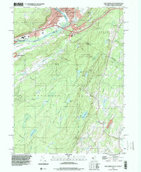
1995 Map of Port Jervis South
USGS Topo · Published 2000About this map
Port Jervis sits at a critical tri-state junction where the Delaware River and Neversink River converge, marking the boundary between New York, New Jersey, and Pennsylvania. The river valley is dominated by major infrastructure, including Interchange 11 and Interchange 1, serving the settled areas of Matamoras and Tristates. South of the urban center, the landscape rises sharply into the Kittatinny Mountain range. This area is heavily defined by conservation and recreation, encompassing the expansive High Point State Park and the Dryden Kuser State Natural Area. The Appalachian Trail threads through this high ground, passing High Point and several remote water bodies like Lake Marcia and Lake Rutherford. In the valley floor, local landmarks such as the Drive-in Theater and Delaware Valley High Sch provide evidence of mid-century community development.
Find a feature on this map
59 named features on this map. Tap any name to fly to it.
Don’t see what you’re looking for? This feature index may not catch every label — zoom into the map to look around manually.
Map Details
Editions of this 1995 Port Jervis South Map
This is the sole edition of this map. No revisions or reprints were ever made.
Other maps of this area

1888 · Franklin
USGS Topo · 1:62,500

1891 · Wallpack
USGS Topo · 1:62,500

1893 · Wallpack
USGS Topo · 1:62,500

1894 · Franklin
USGS Topo · 1:62,500

1897 · Franklin
USGS Topo · 1:62,500

1903 · Franklin Furnace
USGS Topo · 1:62,500

1906 · Port Jervis
USGS Topo · 1:62,500

1908 · Port Jervis
USGS Topo · 1:62,500

1913 · Milford
USGS Topo · 1:62,500

1915 · Milford
USGS Topo · 1:62,500