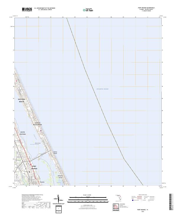
2024 Map of Port Orange
USGS Topo · Published 2024About this map
Port Orange and its neighboring beach communities occupy a narrow coastal strip defined by the Intracoastal Waterway and the Atlantic Ocean. This modern survey illustrates the dense residential and commercial development between the Halifax River and the shoreline, where primary thoroughfares like S Atlantic Ave and S Ridgewood Ave dictate the local geography. The map captures the distinct character of the barrier island, from the high-density areas of Daytona Beach Shores to the unincorporated community of Wilbur-by-the-Sea.
Find a feature on this map
43 named features on this map. Tap any name to fly to it.
Don’t see what you’re looking for? This feature index may not catch every label — zoom into the map to look around manually.
Map Details
Editions of this 2024 Port Orange Map
This is the sole edition of this map. No revisions or reprints were ever made.
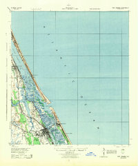
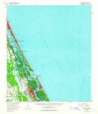
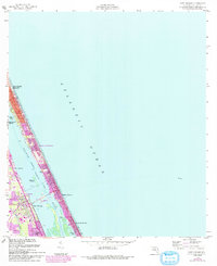
Historical Maps of Daytona Beach Shores Through Time
6 maps found


Featured Locations
- Daytona Beach, FL
- Daytona Beach Shores, FL
- Port Orange, FL
- Wilbur-by-the-Sea, FL
- Halifax Estates, Daytona Beach Shores