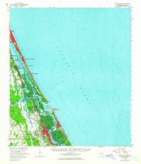
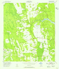
1956 Map of Port Orange
USGS Topo · Published 1964About this map
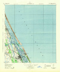
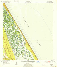
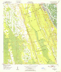
The Florida East Coast railroad corridor anchors the Atlantic coastline in this mid-century survey, tracing the development of Volusia County’s barrier islands and inland waterways. The map illustrates a complex coastal geography where the Intracoastal Waterway threads through the Halifax and Indian River North systems. Significant maritime infrastructure is visible around the Ponce de Leon Inlet, including a Lookout Tower and the U S Coast Guard Reservation. On the mainland and peninsulas, established communities like Port Orange and Daytona Beach Shores appear alongside local landmarks such as Chisholm High Sch and Woodland Cem. The landscape transitions from the urbanized stretches of Daytona Beach to the marshy estuaries of Spruce Creek and Strickland Bay, reflecting an era of expanding coastal settlement before modern intensification.
Find a feature on this map
43 named features on this map. Tap any name to fly to it.
Don’t see what you’re looking for? This feature index may not catch every label — zoom into the map to look around manually.
Map Details
Editions of this 1956 Port Orange Map
This is the sole edition of this map. No revisions or reprints were ever made.
Other maps of this area

1937 · Port Orange
USGS Topo · 1:48,000

1937 · Ormond
USGS Topo · 1:48,000

1943 · Port Orange
USGS Topo · 1:62,500

1944 · Ormond
USGS Topo · 1:62,500
1944 · Port Orange
USGS Topo · 1:62,500
1950 · Ariel
USGS Topo · 1:24,000
1950 · Edgewater
USGS Topo · 1:24,000
1952 · Samsula
USGS Topo · 1:24,000
1952 · Daytona Beach
USGS Topo · 1:24,000

1954 · Daytona Beach
USGS Topo · 1:250,000