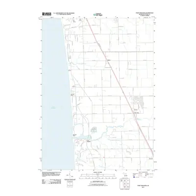
2011 Map of Port Sheldon
USGS Topo · Published 2011About this map
Lake Michigan defines the western edge of this coastal landscape, where the shifting sands meet the mouths of Little Pigeon Creek and the Pigeon River. The settlement of Port Sheldon sits near the river's outlet, while the small communities of West Olive and Agnew are situated further inland along the primary north-south transportation corridor. The map records a mix of residential development and preserved spaces, such as the lakeside retreat of Camp Blodgett and the distinctive dunes at Mountain Beach and Zwemer Beach. Local history and genealogy interest is found in the scattered burial grounds, including Pine Ridge Cemetery and Grand Haven Cemetery to the north, and the Indian Cemetery further south. Further inland, the West Ottawa Golf Course and the West Olive Post Office serve as modern landmarks in this transition zone between the lakefront and the agricultural interior of Ottawa County.
Find a feature on this map
37 named features on this map. Tap any name to fly to it.
Don’t see what you’re looking for? This feature index may not catch every label — zoom into the map to look around manually.
Map Details
Editions of this 2011 Port Sheldon Map
This is the sole edition of this map. No revisions or reprints were ever made.
Other maps of this area

1929 · Holland
USGS Topo · 1:62,500

1930 · Lake Harbor
USGS Topo · 1:48,000

1930 · Muskegon
USGS Topo · 1:62,500

1932 · Holland
USGS Topo · 1:62,500

1936 · Muskegon
USGS Topo · 1:62,500

1936 · Lake Harbor
USGS Topo · 1:62,500

1954 · Milwaukee
USGS Topo · 1:250,000

1958 · Milwaukee
USGS Topo · 1:250,000

1958 · Racine
USGS Topo · 1:250,000

1962 · Racine
USGS Topo · 1:250,000
Featured Places
- Port Sheldon, MI
- Robinson Township, MI
- Grand Haven Charter Township, MI
- Olive Township, MI
- Port Sheldon Township, MI