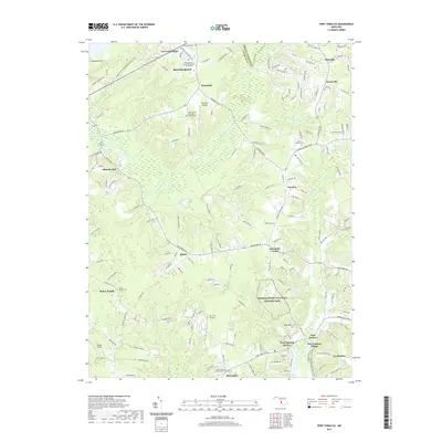
2019 Map of Port Tobacco
USGS Topo · Published 2019About this map
Thomas Stone National Historic Site anchors the southern portion of this region, preserving the landscape associated with one of the signers of the Declaration of Independence. The area is defined by a series of small, dispersed settlements such as Bennsville, Ripley, and Pomfret, reflecting the enduring rural character of Charles County even into the modern era. Waterways like Mattawoman Cr and Old Womans Run carve through the wooded terrain, dictating the placement of historic routes and long-standing community centers.
Find a feature on this map
40 named features on this map. Tap any name to fly to it.
Don’t see what you’re looking for? This feature index may not catch every label — zoom into the map to look around manually.
Map Details
Editions of this 2019 Port Tobacco Map
This is the sole edition of this map. No revisions or reprints were ever made.
Other maps of this area

1889 · Fredericksburg
USGS Topo · 1:125,000

1890 · Mt. Vernon
USGS Topo · 1:125,000

1891 · Mt. Vernon
USGS Topo · 1:125,000

1892 · Fredericksburg
USGS Topo · 1:125,000

1892 · Brandywine
USGS Topo · 1:62,500

1894 · Wicomico
USGS Topo · 1:62,500

1894 · Fredericksburg
USGS Topo · 1:125,000

1894 · Mt. Vernon
USGS Topo · 1:125,000

1895 · Wicomico
USGS Topo · 1:62,500

1895 · Brandywine
USGS Topo · 1:62,500