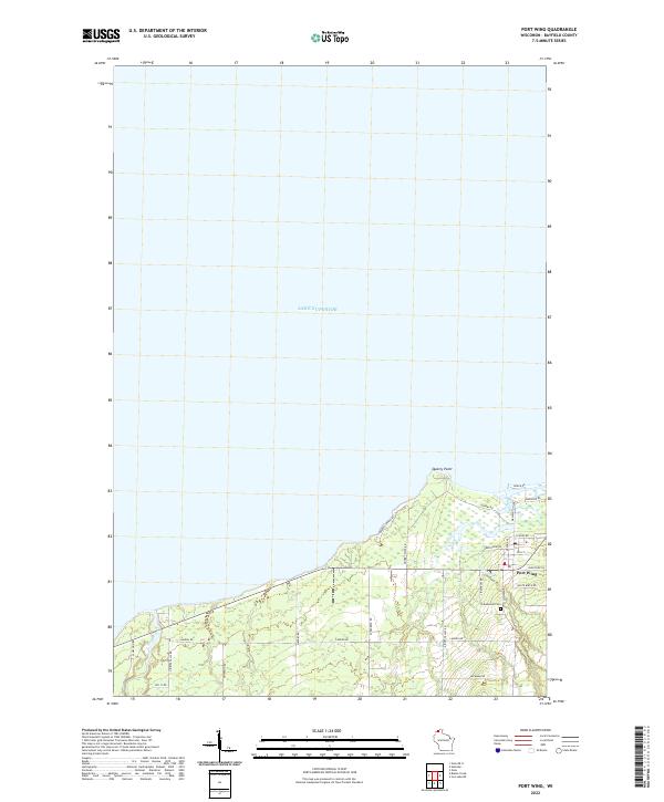
2022 Map of Port Wing
USGS Topo · Published 2022About this map
Lake Superior defines the northern edge of this coastal landscape, where the settlement of Port Wing is situated along the southern shore. This 2022 survey illustrates a quiet harbor community oriented around the waterfront and a grid of local streets including Washington Ave and Grand Ave. To the west, the coastline reaches out toward Quarry Point, accessible via Quarry Point Rd, a name that suggests the area’s industrial heritage in stone extraction. Inland, the map reveals a rural network of roads such as Landon Rd and Beckman Rd that weave through the lowlands of the Iron River and Lost Cr basins. Genealogists will find the Greenwood Cem located southeast of the main town center, while the local Po marks the heart of the village's civic life near the junction of Co Hwy A.
Find a feature on this map
34 named features on this map. Tap any name to fly to it.
Don’t see what you’re looking for? This feature index may not catch every label — zoom into the map to look around manually.
Map Details
Editions of this 2022 Port Wing Map
This is the sole edition of this map. No revisions or reprints were ever made.
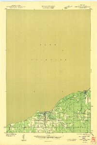
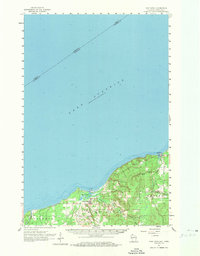
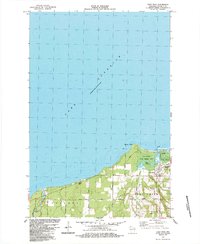
Historical Maps of Port Wing Through Time
6 maps found