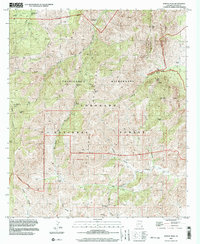
1997 Map of Portal Peak
USGS Topo · Published 2003About this map
The Chiricahua Mountains dominate this 1997 topographic landscape, where the Chiricahua Wilderness and Coronado National Forest converge. This terrain is characterized by deep drainage systems like Cave Creek and Baker Canyon, punctuated by high points such as Portal Peak and Sulphur Peak. The presence of several named springs, including Log Spring and Dripping Spring, indicates the vital water sources required for both wildlife and the occasional human outpost in this high-elevation environment.
Find a feature on this map
78 named features on this map. Tap any name to fly to it.
Don’t see what you’re looking for? This feature index may not catch every label — zoom into the map to look around manually.
Map Details
Editions of this 1997 Portal Peak Map
This is the sole edition of this map. No revisions or reprints were ever made.
Other maps of this area

1917 · Chiricahua
USGS Topo · 1:125,000

1919 · Chiricahua
USGS Topo · 1:125,000

1926 · Rodeo
USGS Topo · 1:62,500

1926 · Rucker
USGS Topo · 1:62,500

1926 · Pedregosa
USGS Topo · 1:62,500

1940 · Apache
USGS Topo · 1:62,500

1955 · Douglas
USGS Topo · 1:250,000

1958 · Chiricahua Peak
USGS Topo · 1:62,500

1958 · Apache
USGS Topo · 1:62,500
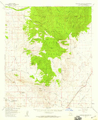
1958 · Pedregosa Mountains
USGS Topo · 1:62,500