
1961 Map of Porter Mountain
USGS Topo · Published 1963About this map
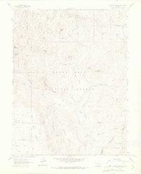
Grand Mesa National Forest and Gunnison National Forest meet at this high-altitude point in the Colorado backcountry, where Mesa and Delta counties converge. The 1961 landscape is defined by a sophisticated network of early water management systems, including the Silver Spruce Ditch, Bull Elk Ditch, and Carnahan Ditch, which redirect high-country runoff across the plateau. High peaks like Porter Mountain and Lenna Peak tower over sprawling open spaces such as Stillwater Park and Grass Park.
Find a feature on this map
46 named features on this map. Tap any name to fly to it.
Don’t see what you’re looking for? This feature index may not catch every label — zoom into the map to look around manually.
Map Details
Editions of this 1961 Porter Mountain Map
4 editions found
Other maps of this area

1955 · The Meadows
USGS Topo · 1:24,000

1957 · Leadville
USGS Topo · 1:250,000

1959 · Leadville
USGS Topo · 1:250,000

1960 · Leadville
USGS Topo · 1:250,000

1960 · Leon Peak
USGS Topo · 1:24,000

1960 · South Mamm Peak
USGS Topo · 1:24,000

1961 · Electric Mountain
USGS Topo · 1:24,000

1961 · Chalk Mountain
USGS Topo · 1:24,000

1961 · Spruce Mountain
USGS Topo · 1:24,000

1962 · Leadville
USGS Topo · 1:250,000