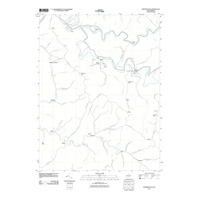
2011 Map of Porters Falls
USGS Topo · Published 2011About this map
Fishing Creek and its tributary Little Fishing Creek carve a winding course through this Tyler County landscape, anchoring a series of small settlements and family burial grounds. The community of Porters Falls serves as a local hub, home to the Porters Falls Post Office and situated where the creek meets State Run. Throughout the surrounding ridges, such as Martinsville Ridge and Chiselfinger Ridge, numerous family cemeteries are preserved, including the Wells Cemetery, Yoho Cemetery, and Fluharty Cemetery.
Find a feature on this map
92 named features on this map. Tap any name to fly to it.
Don’t see what you’re looking for? This feature index may not catch every label — zoom into the map to look around manually.
Map Details
Editions of this 2011 Porters Falls Map
This is the sole edition of this map. No revisions or reprints were ever made.
Other maps of this area

1903 · Littleton
USGS Topo · 1:62,500

1905 · Centerpoint
USGS Topo · 1:62,500

1905 · West Union
USGS Topo · 1:62,500

1905 · Littleton
USGS Topo · 1:62,500

1906 · New Martinsville
USGS Topo · 1:62,500

1924 · New Martinsville
USGS Topo · 1:62,500

1924 · Centerpoint
USGS Topo · 1:62,500

1924 · Littleton
USGS Topo · 1:62,500

1924 · West Union
USGS Topo · 1:62,500

1925 · Centerpoint
USGS Topo · 1:62,500