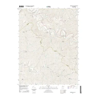
2014 Map of Porters Falls
USGS Topo · Published 2014About this map
Fishing Creek and its many tributaries, including Hupp Run and Fluharty Run, carve a complex network of hollows across the border of Wetzel and Tyler counties. Small settlements like Porters Falls, Minnie, and Veto are concentrated along these watercourses, connected by routes like WV-20 and WV-7. The map reveals a landscape defined by high, narrow divides such as Martinsville Ridge and Chiselfinger Ridge, which separate the drainage of Elk Fork from the main creek valley. Numerous family and community burial sites, including Cherry Grove Cem, Yoho Cem, and Simpson Cem, are scattered across the hillsides, providing valuable points of interest for genealogical research in this part of West Virginia. The infrastructure of the region is further marked by a prominent Gas Line and the presence of Wise Acrs near the northern boundary.
Find a feature on this map
81 named features on this map. Tap any name to fly to it.
Don’t see what you’re looking for? This feature index may not catch every label — zoom into the map to look around manually.
Map Details
Editions of this 2014 Porters Falls Map
This is the sole edition of this map. No revisions or reprints were ever made.
Other maps of this area

1903 · Littleton
USGS Topo · 1:62,500

1905 · Centerpoint
USGS Topo · 1:62,500

1905 · West Union
USGS Topo · 1:62,500

1905 · Littleton
USGS Topo · 1:62,500

1906 · New Martinsville
USGS Topo · 1:62,500

1924 · New Martinsville
USGS Topo · 1:62,500

1924 · Centerpoint
USGS Topo · 1:62,500

1924 · Littleton
USGS Topo · 1:62,500

1924 · West Union
USGS Topo · 1:62,500

1925 · Centerpoint
USGS Topo · 1:62,500