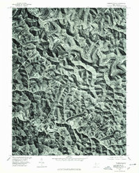
1976 Map of Porters Falls
USGS Topo · Published 1979About this map
Fishing Creek carves a winding, serpentine path through the deeply dissected terrain of Wetzel County, shaping the location of the area's primary settlements. This orthophoto map, created from aerial imagery captured in the mid-1970s, reveals how the narrow valley floors dictated the placement of communities like Porters Falls and Minnie. While the upland ridges are heavily forested, the creek bottoms show the clearings of small farmsteads and transport corridors that follow the water's natural course. The map provides a unique visual record of the West Virginia landscape before modern development, showing the exact footprint of these small hamlets and the intense texture of the surrounding hillsides as they appeared in 1976.
Find a feature on this map
3 named features on this map. Tap any name to fly to it.
Don’t see what you’re looking for? This feature index may not catch every label — zoom into the map to look around manually.
Map Details
Editions of this 1976 Porters Falls Map
This is the sole edition of this map. No revisions or reprints were ever made.
Other maps of this area

1903 · Littleton
USGS Topo · 1:62,500

1905 · Centerpoint
USGS Topo · 1:62,500

1905 · West Union
USGS Topo · 1:62,500

1905 · Littleton
USGS Topo · 1:62,500

1906 · New Martinsville
USGS Topo · 1:62,500

1924 · New Martinsville
USGS Topo · 1:62,500

1924 · Centerpoint
USGS Topo · 1:62,500

1924 · Littleton
USGS Topo · 1:62,500

1924 · West Union
USGS Topo · 1:62,500

1925 · Centerpoint
USGS Topo · 1:62,500