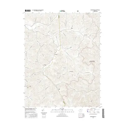
2016 Map of Portersburg
USGS Topo · Published 2016About this map
Portersburg and the surrounding woodlands of the Daniel Boone National Forest define this corner of Clay and Laurel Counties. The landscape is characterized by a dense network of hollows and ridges, with small settlements like Deer Lick, Langnau, and Crawford situated along the winding valley floors. The road network often follows these natural contours, as seen with Dripping Springs Rd and Mill Creek Rd, while high points such as Raccoon Mtn and High Knob overlook the deeply dissected terrain. Many of the local routes, including Reams Cemetery Rd and Salem Church Rd, reflect a long history of local access to remote family homesteads and community landmarks. This 2016 survey highlights the persistent rural character of southeastern Kentucky, where small unincorporated communities remain anchored to the intricate drainage systems and ridge lines of the Appalachian plateau.
Find a feature on this map
58 named features on this map. Tap any name to fly to it.
Don’t see what you’re looking for? This feature index may not catch every label — zoom into the map to look around manually.
Map Details
Editions of this 2016 Portersburg Map
This is the sole edition of this map. No revisions or reprints were ever made.
Other maps of this area

1891 · Manchester
USGS Topo · 1:125,000

1893 · London
USGS Topo · 1:125,000

1897 · London
USGS Topo · 1:125,000

1952 · Portersburg
USGS Topo · 1:24,000

1952 · Hima
USGS Topo · 1:24,000

1952 · Blackwater
USGS Topo · 1:24,000

1952 · Lily
USGS Topo · 1:24,000

1952 · Manchester
USGS Topo · 1:24,000

1952 · London
USGS Topo · 1:24,000

1953 · Tyner
USGS Topo · 1:24,000