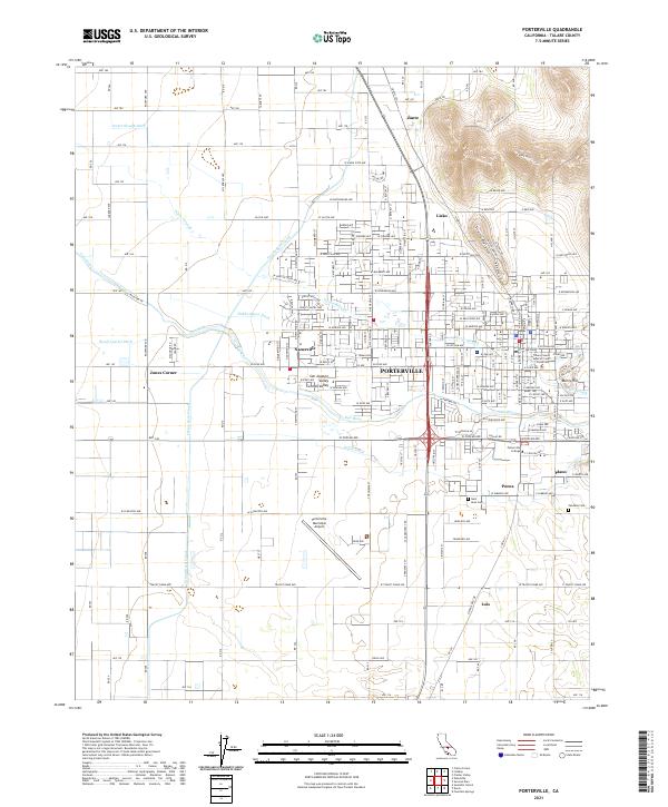
2021 Map of Porterville
USGS Topo · Published 2021About this map
Porterville serves as the focal point of this San Joaquin Valley landscape, where the Tule River emerges from the foothills near Lewis Hill. The map documents a sophisticated irrigation network vital to the Central Valley economy, featuring the prominent Friant-Kern Canal alongside numerous ditches such as the Porter Slough Ditch, Wood Central Ditch, and Poplar Ditch. Small settlements and named junctions like Zante, Lisko, Nanceville, and Plano dot the periphery, reflecting the region's agricultural history. Local institutions are well-represented, including Porterville College and the Tulare County Superior Court Porterville. Genealogists may find interest in the locations of Saint Anns Cem and Vandalia Cem, while the Porterville Municipal Airport indicates the infrastructure supporting this regional hub.
Find a feature on this map
129 named features on this map. Tap any name to fly to it.
Don’t see what you’re looking for? This feature index may not catch every label — zoom into the map to look around manually.
Map Details
Editions of this 2021 Porterville Map
This is the sole edition of this map. No revisions or reprints were ever made.
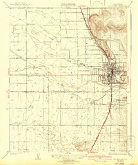
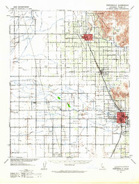
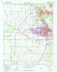
Historical Maps of Westfield Through Time
4 maps found