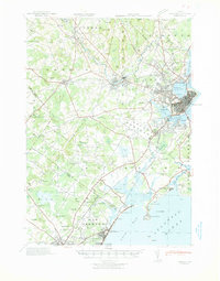
1941 Map of Portland
USGS Topo · Published 1941About this map
The Presumpscot River and Stroudwater River systems anchor this coastal Maine landscape, driving the industrial development of Westbrook and Gorham. By the early 1940s, the area’s economic identity was defined by the intersection of water power and rail transit, with Saccarappa Falls and Cumberland Mills highlighting the persistent importance of river-based manufacturing. The urban core of Portland extends through Woodfords and East Deering, while the southern reaches near Old Orchard and Scarboro reveal a transition from marshy lowlands like Rigby Bog to prominent coastal landmarks such as Prouts Neck. Small rural schools including Babb Sch and Sawyer Sch are scattered across the interior, alongside community landmarks like the Heath Meetinghouse and North Street Ch. This survey illustrates a coastal region where dense rail networks, including the Boston and Maine RR, were tightly integrated with established river towns and developing shorefronts.
Find a feature on this map
149 named features on this map. Tap any name to fly to it.
Don’t see what you’re looking for? This feature index may not catch every label — zoom into the map to look around manually.
Map Details
Editions of this 1941 Portland Map
This is the sole edition of this map. No revisions or reprints were ever made.
Other maps of this area

1891 · Portland
USGS Topo · 1:62,500

1891 · Biddeford
USGS Topo · 1:62,500

1891 · Kennebunk
USGS Topo · 1:62,500

1891 · Buxton
USGS Topo · 1:62,500

1892 · Freeport
USGS Topo · 1:62,500

1892 · Buxton
USGS Topo · 1:62,500

1893 · Kennebunk
USGS Topo · 1:62,500

1893 · Biddeford
USGS Topo · 1:62,500

1893 · Portland
USGS Topo · 1:62,500

1893 · Casco Bay
USGS Topo · 1:62,500