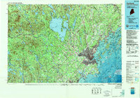
1985 Map of Portland
USGS Topo · Published 1988About this map
Casco Bay and its complex archipelago define the coastal character of this mid-1980s survey, where the urban centers of Portland and South Portland meet the Atlantic. The landscape transitions from the dense street grids and industrial waterfronts of the coast to the interior's expansive water bodies, dominated by Sebago Lake and Little Sebago Lake. This era shows the mature development of the region's transportation infrastructure, including the Maine Turnpike and Interstate 295, alongside the historical rail corridors of the Maine Central RR and Canadian National Ry. Beyond the suburban growth in Westbrook and Falmouth, the map details a terrain of notable heights like Douglas Hill and the Burnt Meadow Mountains. Significant coastal and inland recreation areas are well-established, from Sebago Lake State Park to the rocky shoreline of Two Lights State Park, while the Brunswick Naval Air Station remains a prominent military installation on the eastern edge.
Find a feature on this map
140 named features on this map. Tap any name to fly to it.
Don’t see what you’re looking for? This feature index may not catch every label — zoom into the map to look around manually.
Map Details
Editions of this 1985 Portland Map
2 editions found
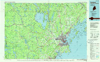
Other maps of this area

1891 · Portland
USGS Topo · 1:62,500

1891 · Biddeford
USGS Topo · 1:62,500

1891 · Berwick
USGS Topo · 1:62,500

1891 · Kennebunk
USGS Topo · 1:62,500

1891 · Buxton
USGS Topo · 1:62,500

1891 · Newfield
USGS Topo · 1:62,500

1892 · Gardiner
USGS Topo · 1:62,500

1892 · Freeport
USGS Topo · 1:62,500

1892 · Buxton
USGS Topo · 1:62,500

1893 · Kennebunk
USGS Topo · 1:62,500