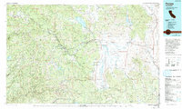
1979 Map of Portola
USGS Topo · Published 1993About this map
The Middle Fork Feather River carves a path through the heart of this High Sierra landscape, anchoring a network of timber and rail towns at the end of the 1970s. This survey captures the region just as recreational water bodies like Lake Davis and Frenchman Lake had become established fixtures within the Plumas National Forest. The map documents a critical transportation corridor where the Western Pacific RR follows the river canyons to serve settlements like Portola, Sloat, and Cromberg. To the south, the expansive Sierra Valley provides a stark topographical contrast, hosting the agricultural hubs of Loyalton and Sierraville. The inclusion of the historic gold-country county seats of Quincy and Downieville on a single sheet highlights the distinct transition from the narrow, steep-walled canyons of the west to the high-altitude basins and the Diamond Mountains in the east.
Find a feature on this map
64 named features on this map. Tap any name to fly to it.
Don’t see what you’re looking for? This feature index may not catch every label — zoom into the map to look around manually.
Map Details
Editions of this 1979 Portola Map
2 editions found
Other maps of this area

1886 · Honey Lake
USGS Topo · 1:250,000

1886 · Lassen Peak
USGS Topo · 1:250,000

1886 · Granite Range
USGS Topo · 1:250,000

1888 · Smartsville
USGS Topo · 1:125,000

1888 · Bidwell Bar
USGS Topo · 1:125,000

1890 · Sierraville
USGS Topo · 1:125,000

1891 · Bidwell Bar
USGS Topo · 1:125,000

1891 · Downieville
USGS Topo · 1:125,000

1891 · Honey Lake
USGS Topo · 1:250,000

1891 · Carson
USGS Topo · 1:125,000