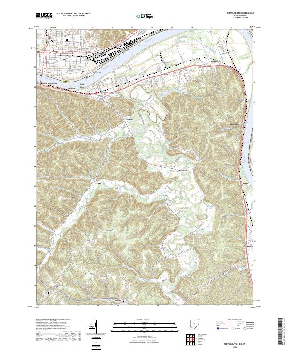
2023 Map of Portsmouth
USGS Topo · Published 2023About this map
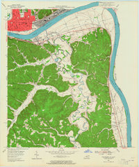
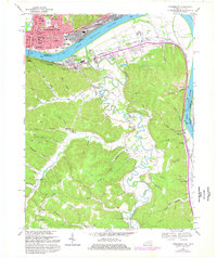
Portsmouth serves as a focal point along the northern banks of the Ohio River, where the grid of city streets like Front St and Gallia St meets the campus of Shawnee State University. Across the water in Kentucky, the terrain transitions into a dense network of ridges and hollows, characterized by the steep ascent to Civil War Ridge and Pebble Hill. Small riverfront communities including Fullerton, South Shore, and South Portsmouth line the southern shore, while deeper in the Kentucky interior, settlements like Maloneton and Beechy are connected by winding creeks such as Tygarts Creek and Schultz Creek. This area illustrates the enduring importance of the river corridor, with the Ohio Kentucky railroad following the bank and numerous family cemeteries, such as Howe Cem and Fannin Cem, dotting the rural landscape away from the urban center.
Find a feature on this map
131 named features on this map. Tap any name to fly to it.
Don’t see what you’re looking for? This feature index may not catch every label — zoom into the map to look around manually.
Map Details
Editions of this 2023 Portsmouth Map
This is the sole edition of this map. No revisions or reprints were ever made.
Historical Maps of Maloneton Through Time
3 maps found