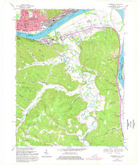
1968 Map of Portsmouth
USGS Topo · Published 1977About this map
Portsmouth serves as the focal point for this 1968 survey, showing the Ohio riverfront as it appeared before major modern industrial shifts. The city's dense grid, complete with landmarks like Notre Dame and Greenlawn Cem, transitions into the industrial corridor of New Boston and across the Ohio River to South Shore, Kentucky. This cross-river relationship is physically anchored by the U S Grant Bridge and the extensive rail infrastructure of the Norfolk and Western and Chesapeake and Ohio lines.
Find a feature on this map
87 named features on this map. Tap any name to fly to it.
Don’t see what you’re looking for? This feature index may not catch every label — zoom into the map to look around manually.
Map Details
Editions of this 1968 Portsmouth Map
2 editions found
Other maps of this area

1911 · Sciotoville
USGS Topo · 1:62,500

1913 · Sciotoville
USGS Topo · 1:62,500

1915 · Garrison
USGS Topo · 1:62,500

1915 · Otway
USGS Topo · 1:62,500

1917 · Otway
USGS Topo · 1:62,500

1918 · Garrison
USGS Topo · 1:62,500

1926 · Greenup
USGS Topo · 1:48,000

1930 · Greenup
USGS Topo · 1:62,500

1949 · Friendship
USGS Topo · 1:24,000

1949 · Brushart
USGS Topo · 1:24,000