
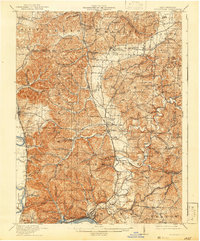
1913 Map of Sciotoville
USGS Topo · Published 1924About this map
The Ohio River corridor and its industrial northern banks define this 1913 survey, where river-based transport intersects with an extensive network of rail lines including the Norfolk and Western RR and the Chesapeake and Ohio RR. Near the river's edge, the Star Brickyard and the community of Sciotoville suggest an era of active manufacturing. Further inland, the landscape is characterized by narrow valleys and steep ridges, such as Niner Hill and Strauss Ridge, which are dotted with dozens of one-room schoolhouses like Bonser Run School and Tick Ridge School.
Find a feature on this map
153 named features on this map. Tap any name to fly to it.
Don’t see what you’re looking for? This feature index may not catch every label — zoom into the map to look around manually.
Map Details
Editions of this 1913 Sciotoville Map
2 editions found
Other maps of this area

1898 · Ironton
USGS Topo · 1:62,500

1900 · Ironton
USGS Topo · 1:62,500

1906 · Waverly
USGS Topo · 1:62,500

1908 · Waverly
USGS Topo · 1:62,500

1911 · Sciotoville
USGS Topo · 1:62,500

1912 · Oak Hill
USGS Topo · 1:62,500

1913 · Jackson
USGS Topo · 1:62,500

1915 · Garrison
USGS Topo · 1:62,500

1915 · Otway
USGS Topo · 1:62,500

1915 · Piketon
USGS Topo · 1:62,500