Old Maps of Scioto County, Ohio
Explore 189 old maps of Scioto County, spanning from 1898 to today. These high-resolution historic maps reveal how streets, neighborhoods, landmarks, and natural features evolved over time — perfect for genealogy, metal detecting, research, and local history exploration.
What you can do with these maps:
- See how Scioto County changed over time: Compare historical maps to modern-day views to trace roads, homesites, rail lines & more.
- View detailed metadata: Each map includes creators, publishers, year, scale, and archive source.
- Overlay maps with satellite & LiDAR: Visualize the past alongside modern tools to explore terrain & human change.
- Trusted historical sources: Maps sourced from the USGS, Library of Congress, and other archives.
- Access maps your way: View online, download high-res files, or order prints for personal or research use.
Start exploring old maps of Scioto County to uncover forgotten places, hidden landmarks, and the deep history beneath your feet.
Scioto County, OH maps
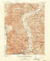
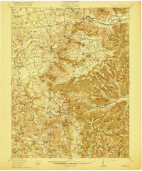
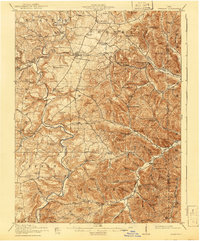
(189)- 1898 Map of Ironton, 1955 Print
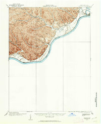
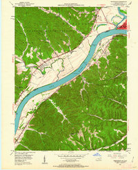
 1898 Ironton1955 Print · USGSSouthern Ohio's iron-producing region and the bustling riverfront at Ironton are documented here just before the turn of the century. Genealogists can trace family footprints near Vesuvius Furnace, Woodland Cemetery, and old post offices like Culbertson P.O.
 - 1900 Map of Ironton, 1918 Print
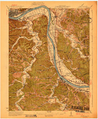
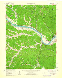
 1900 Ironton1918 Print · USGSThe Ohio River valley and the iron-rich hills of Lawrence County are seen here at the turn of the century during a peak in industrial activity. Genealogists and historians can trace defunct post offices like Orr P.O. and explore the rail corridors of the Ironton R.R. and Cincinnati Hamilton & Dayton R.R.2 unique versions available
 - 1911 Map of Sciotoville, 1952 Print
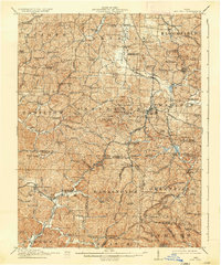
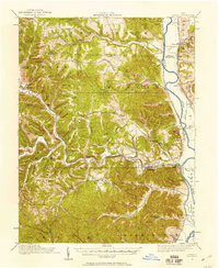
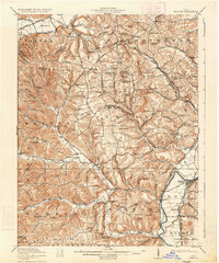
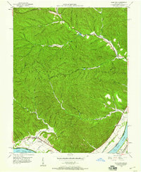
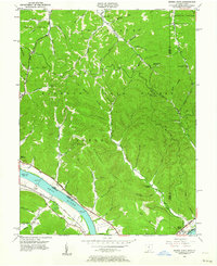
 1911 Sciotoville1952 Print · USGSThe industrial riverfronts and rural hollows of southern Ohio are shown here in the early twentieth century before modern development. Genealogists and historians can trace numerous rural landmarks like Davis Sta George PO, Harrison Furnace School, and the brickyards near New Boston.2 unique versions available
 - 1912 Map of Oak Hill, 1935 Print
 1912 Oak Hill1935 Print · USGSSouthern Ohio's iron-producing hill country is captured here during its industrial peak before the mid-century decline. Genealogists and historians can locate family homesites near landmark sites like Jefferson Furnace, the village of South Webster, and dozens of rural schools including Riegel School.2 unique versions available
 - 1913 Map of Sciotoville, 1924 Print
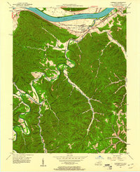
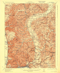 1913 Sciotoville1924 Print · USGSScioto County during the early twentieth century shows a landscape of river-front industry and deep-hollow settlements. Genealogists can trace family footprints across dozens of local school sites like Noel School and early industrial markers such as Scioto Furnace and Star Brickyard.2 unique versions available
 - 1915 Map of Bainbridge
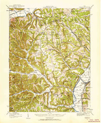
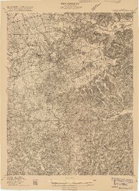 1915 Bainbridge1915 Print · USGSBefore the modernization of rural Ohio, this 1915 survey captures Highland and Ross counties when one-room schoolhouses and country churches anchored every ridge. Trace family roots at Bainbridge, find the Indian Mound on Paint Creek, or locate Fall Creek Church and Redkey School.2 unique versions available
 - 1915 Map of Garrison, 1952 Print
 1915 Garrison1952 Print · USGSThe riverfront and uplands of the Ohio Valley come alive in this mid-century publication of a Great War-era survey. Genealogists and local historians can trace the many rural schoolhouses like Elmtree School and Leatherwood School or find the early footprint of Portsmouth.
 - 1915 Map of Otway, 1958 Print
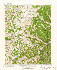
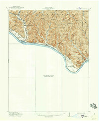
 1915 Otway1958 Print · USGSScioto and Pike Counties come alive in the decade before the First World War, showing a rural landscape anchored by the river and the rail. Researchers can trace dozens of country schoolhouses like Wetmore School and old rail stops at Otway or McDermott.2 unique versions available
 - 1915 Map of Piketon, 1959 Print
 1915 Piketon1959 Print · USGSPike and Ross Counties are shown in the mid-1910s during a height of rural settlement and local industry. Genealogists can locate dozens of country schoolhouses like Yankee Hill School and vanished post offices such as Bethel Pike PO.
 - 1916 Map of Peebles, 1962 Print
 1916 Peebles1962 Print · USGSIn the early twentieth century, the rural landscape of Adams County was defined by its winding creeks and a dense network of one-room schoolhouses. Researchers can trace the Norfolk and Western RR corridor through Peebles or find ancestral locations like Marble Furnace and Bacon Flat School.
 - 1917 Map of Bainbridge
 1917 Bainbridge1917 Print · USGSIn the decade before modern highways, this Ohio highland region was a land of ridge-top schools and creek-side mills. Genealogists and historians can locate numerous rural schoolhouses like Walnut Shade School and ancient landmarks including the famous Serpent Mound.4 unique versions available
 - 1917 Map of Piketon, 1934 Print
 1917 Piketon1934 Print · USGSThe Scioto River valley and its surrounding hill country are captured here during the first World War era, showing a landscape of small farmsteads and ancient earthworks. Genealogists can trace family roots through dozens of named rural landmarks like Seip Mound, Bethel Pike PO, and Mound Cemetery.2 unique versions available
 - 1917 Map of Otway, 1941 Print
 1917 Otway1941 Print · USGSScioto and Pike Counties are shown in great detail during the era of steam railroading and rural schoolhouses. You can trace the Norfolk and Western RR through Otway or locate family roots at sites like Hackworth Hill School and McDermott.
 - 1918 Map of Garrison, 1932 Print
 1918 Garrison1932 Print · USGSThe river valley at the Ohio and Kentucky border was a landscape of small schools and isolated runs during the mid-1910s. Researchers can trace the placement of local institutions like the Scioto County Infirmary and rural schools including Pond Run School and Carey Run School.
 - 1918 Map of Peebles, 1941 Print
 1918 Peebles1941 Print · USGSIn the hills of southern Ohio during the Great War era, the landscape is a network of small schoolhouses and creek-side settlements. Genealogists can trace family footprints near Peebles or Locust Grove through dozens of sites like Marble Furnace and Mt Zion School.2 unique versions available
 - 1919 Map of Vanceburg, 1938 Print
 1919 Vanceburg1938 Print · USGSThe Ohio River shoreline at the close of the Great War was a landscape of small river towns and remote ridge-top schools. Genealogists can trace family footprints at Stout PO, Sandy Springs, and the Cedar College School in the rugged hills north of the river.2 unique versions available
 - 1926 Map of Greenup
 1926 Greenup1926 Print · USGSGreenup County in the mid-1920s is a landscape of riverfront rail towns and a high density of rural schoolhouses tucked into the Kentucky hollows. Genealogists and historians can trace family locations near Old Steam Furnace School, Nonchalanta, and Taylor Sta McCall PO.3 unique versions available
 - 1930 Map of Greenup
 1930 Greenup1930 Print · USGSThe industrial corridor of the Ohio River valley is captured here in the early twentieth century, showing the borderlands of Greenup County and southern Ohio. Researchers can trace the legacy of iron production at Franklin Furnace or locate family roots near Tongs P O and Wurtland.3 unique versions available
 - 1944 Map of Piketon
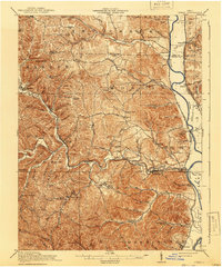
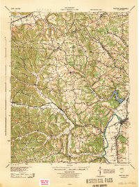 1944 Piketon1944 Print · USGSSouthern Ohio's hill country meets the Scioto River valley in the mid-1940s, a landscape defined by ancient earthworks and rugged ridge-top schoolhouses. Researchers can locate family landmarks like the County Home, trace the Norfolk and Western RR, or find vanished community hubs like Bethel Pike PO and Morgantown.
 - 1947 Map of Columbus, 1948 Print
 1947 Columbus1948 Print · USGSCentral Ohio in the late 1940s is captured in this survey, showing the post-war transition of its rail hubs and military airfield expansions. Genealogists and historians can trace the paths of the Ohio Canal, the Pennsylvania RR lines, and the Camp Sherman Military Reservation.
 - 1949 Map of Pond Run, 1960 Print
 1949 Pond Run1960 Print · USGSThe rugged interior of Scioto County is captured here in the late 1940s, just as state forest management was maturing. Genealogists can locate family landmarks like McDermott Cem and Elmtree Sch, or trace the path of the Chesapeake and Ohio through Quincy.
 - 1949 Map of Vanceburg, 1960 Print
 1949 Vanceburg1960 Print · USGSThe Ohio River valley and the rugged hills of Lewis County are captured here just after the war. Local historians can trace family roots through numerous country landmarks like Beasley Fork Chapel, Aills Cem, and the County Infirmary.
 - 1949 Map of Garrison, 1961 Print
 1949 Garrison1961 Print · USGSThe Ohio River valley and the interior hollows of Lewis County are captured here just after the war. Genealogists can trace family landmarks like the Waring Cem, Red Brush Sch, and several rural churches along Kinniconick Creek.5 unique versions available
 - 1949 Map of Friendship, 1962 Print
 1949 Friendship1962 Print · USGSThe Ohio River valley near the turn of the mid-century reveals a landscape of industrial river transport and deep-hollow settlements. Researchers can trace the legacy of rural education and faith at Lower Carey Run Sch, Pine Grove Sch, and Nace Run Tabernacle.
 - 1949 Map of Buena Vista, 1964 Print
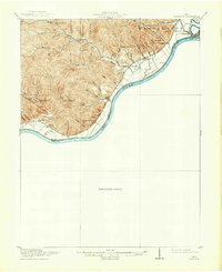
 1949 Buena Vista1964 Print · USGSThe Ohio River borderlands of the late 1940s reveal a landscape of river navigation and forest management. Researchers can trace riverside life at Rome (Stout PO), locate the Twin Creek Lookout Tower, and find rural congregations like Aills Chapel.
Showing maps 1-25 of 189
Top cities of Scioto County
- Portsmouth historical maps
- New Boston historical maps
- South Webster historical maps
- Rarden historical maps
- Otway historical maps
Frequently asked questions
- What are the different types of historical maps available for Scioto County?
- What is the oldest map of Scioto County?
- Where can I purchase historical maps of Scioto County for my home or office?
- Where can I download high-res historical maps of Scioto County?
- Are there historical topographic maps available for Scioto County?
- Is there historical aerial imagery available for Scioto County?
- Where are historical maps of Scioto County sourced from?