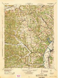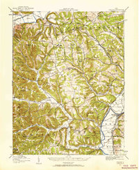
1915 Map of Piketon
USGS Topo · Published 1959About this map
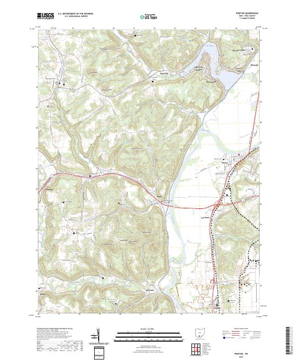
The Scioto River valley dominates the eastern edge of this region, providing a flat corridor for the Norfolk and Western Ry and the town of Piketon. Moving west, the landscape breaks into a complex network of knobs and ridges, including Soms Knob and Pinnacle Knob. This rugged terrain is punctuated by small, family-centric settlements and an extensive network of rural schools like Potts Hill School, Yankee Hill School, and Leet Creek School, indicating a period of high rural population density before mid-century consolidation.
Find a feature on this map
155 named features on this map. Tap any name to fly to it.
Don’t see what you’re looking for? This feature index may not catch every label — zoom into the map to look around manually.
Map Details
Editions of this 1915 Piketon Map
This is the sole edition of this map. No revisions or reprints were ever made.
Historical Maps of Waverly Through Time
9 maps found