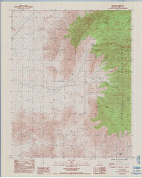
1984 Map of Potosi
USGS Topo · Published 1985About this map
Potosi Mine and its surrounding mining landscape dominate this mid-1980s survey of the high desert terrain southwest of Las Vegas. The area is defined by the steep elevation changes of the Spring Mountains, where industrial history is marked by the presence of Potosi Ruins and numerous prospect pits. This map documents a specialized environment where water sources like Potosi Spring and Mexican Spring were essential for both the settlement at Potosi and the recovery of ore. The topographical detail highlights the significance of natural corridors such as Potosi Pass and Wilson Pass, providing a clear record of the access routes used during the region's mining operations. Modern infrastructure is represented by a single-pole transmission line cutting across the Potosi Wash, contrasting with the older geological and industrial features of Potosi Mtn.
Find a feature on this map
12 named features on this map. Tap any name to fly to it.
Don’t see what you’re looking for? This feature index may not catch every label — zoom into the map to look around manually.
Map Details
Editions of this 1984 Potosi Map
This is the sole edition of this map. No revisions or reprints were ever made.
Other maps of this area

1907 · Las Vegas
USGS Topo · 1:250,000

1908 · Las Vegas
USGS Topo · 1:250,000

1910 · Ivanpah
USGS Topo · 1:250,000

1912 · Ivanpah
USGS Topo · 1:250,000

1942 · Ivanpah
USGS Topo · 1:250,000

1947 · Kingman
USGS Topo · 1:250,000

1948 · Kingman
USGS Topo · 1:250,000

1952 · Blue Diamond
USGS Topo · 1:62,500

1954 · Las Vegas
USGS Topo · 1:250,000

1954 · Kingman
USGS Topo · 1:250,000