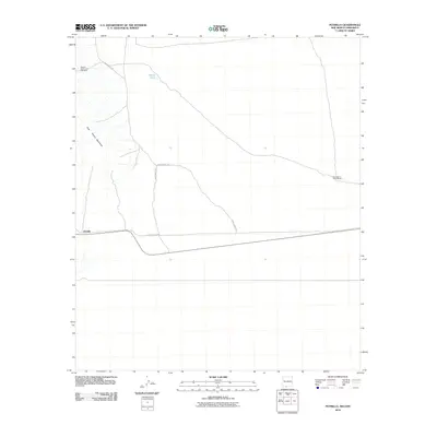
2010 Map of Potrillo
USGS Topo · Published 2010About this map
Potrillo anchors this high-desert landscape in Doña Ana County, where the transition from desert floor to the East Potrillo Mountains dominates the western edge. This 2010 survey illustrates a sparse ranching and industrial environment, defined by isolated landmarks such as Herrington's Home Ranch and the Federal Number One Mine. The transportation network is limited to arterial routes like A 008 County Rd and A 009 County Rd, which cut across the arid terrain to connect distant outposts. Water resources are critical in this environment, represented here by Gerrys Tank, a necessary feature for sustaining life and livestock in the southern New Mexico borderlands. The map provides a clear look at land use in the early 21st century, showing where human activity meets the stark natural features of the Potrillo volcanic field area.
Find a feature on this map
7 named features on this map. Tap any name to fly to it.
Don’t see what you’re looking for? This feature index may not catch every label — zoom into the map to look around manually.
Map Details
Editions of this 2010 Potrillo Map
This is the sole edition of this map. No revisions or reprints were ever made.
Other maps of this area

1917 · Noria
USGS Topo · 1:62,500

1917 · Mt. Riley
USGS Topo · 1:62,500

1918 · Mt. Riley
USGS Topo · 1:62,500

1918 · Noria
USGS Topo · 1:62,500

1929 · Mt. Riley
USGS Topo · 1:62,500

1951 · Mt. Riley
USGS Topo · 1:62,500

1953 · El Paso
USGS Topo · 1:250,000

1959 · El Paso
USGS Topo · 1:250,000

1964 · El Paso
USGS Topo · 1:250,000

1965 · El Paso
USGS Topo · 1:250,000