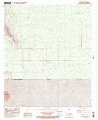
1985 Map of Potrillo
USGS Topo · Published 1985About this map
Potrillo sits on the high desert plains of the borderlands, positioned just north of the international boundary between the United States of America and Mexico. This 1985 survey captures a stark landscape defined by the East Potrillo Mountains which rise sharply in the west, while the cinder cone of El Volcan stands isolated to the south across the border in Chihuahua. Evidence of ranching and water management in this arid environment is visible through features like Gerrys Tank, a critical landmark for local navigation and land use. The map illustrates the geometric precision of the New Mexico principal meridian as it intersects the rugged Chihuahuan Desert terrain of Doña Ana County.
Find a feature on this map
8 named features on this map. Tap any name to fly to it.
Don’t see what you’re looking for? This feature index may not catch every label — zoom into the map to look around manually.
Map Details
Editions of this 1985 Potrillo Map
This is the sole edition of this map. No revisions or reprints were ever made.
Other maps of this area

1917 · Noria
USGS Topo · 1:62,500

1917 · Mt. Riley
USGS Topo · 1:62,500

1918 · Mt. Riley
USGS Topo · 1:62,500

1918 · Noria
USGS Topo · 1:62,500

1929 · Mt. Riley
USGS Topo · 1:62,500

1951 · Mt. Riley
USGS Topo · 1:62,500

1953 · El Paso
USGS Topo · 1:250,000

1959 · El Paso
USGS Topo · 1:250,000

1964 · El Paso
USGS Topo · 1:250,000

1965 · El Paso
USGS Topo · 1:250,000