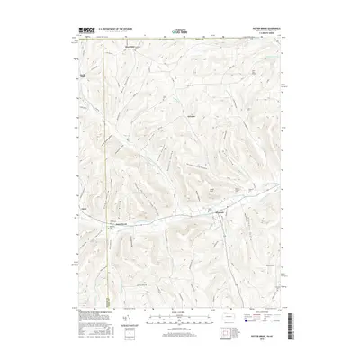
2016 Map of Potter Brook
USGS Topo · Published 2016About this map
Westfield and the neighboring settlements of Potter Brook and Cowanesque follow the winding course of the Cowanesque River as it cuts through the high plateaus of the Pennsylvania-New York border. This terrain is defined by a dense network of steep hollows named for local families and early settlers, including Gene Brown Hollow, Kocher Hollow, Rexford Hollow, and Miller Hollow. These narrow valleys drain into the river and its major tributaries like the North Fork Cowanesque River and Purple Brook.
Find a feature on this map
77 named features on this map. Tap any name to fly to it.
Don’t see what you’re looking for? This feature index may not catch every label — zoom into the map to look around manually.
Map Details
Editions of this 2016 Potter Brook Map
This is the sole edition of this map. No revisions or reprints were ever made.
Other maps of this area

1899 · Gaines
USGS Topo · 1:62,500

1900 · Gaines
USGS Topo · 1:62,500

1900 · Elkland
USGS Topo · 1:62,500

1924 · Woodhull
USGS Topo · 1:48,000

1926 · Woodhull
USGS Topo · 1:62,500

1926 · Greenwood
USGS Topo · 1:62,500

1944 · Woodhull
USGS Topo · 1:62,500

1950 · Elmira
USGS Topo · 1:250,000

1953 · Woodhull
USGS Topo · 1:24,000

1954 · Williamsport
USGS Topo · 1:250,000