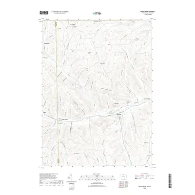
2019 Map of Potter Brook
USGS Topo · Published 2019About this map
The Cowanesque River corridor anchors this portion of northern Pennsylvania, where the settlements of Westfield and Potter Brook follow the valley floor. Steep terrain rises sharply from the riverbanks, defined by a network of family-named hollows including Broughton Hollow, Hancock Hollow, and Dibble Hollow. The topography is dominated by significant elevations such as Asaph Peak and Reitter Hill, while the Potter and Tioga county line cuts vertically through the western portion of the map.
Find a feature on this map
89 named features on this map. Tap any name to fly to it.
Don’t see what you’re looking for? This feature index may not catch every label — zoom into the map to look around manually.
Map Details
Editions of this 2019 Potter Brook Map
This is the sole edition of this map. No revisions or reprints were ever made.
Other maps of this area

1899 · Gaines
USGS Topo · 1:62,500

1900 · Gaines
USGS Topo · 1:62,500

1900 · Elkland
USGS Topo · 1:62,500

1924 · Woodhull
USGS Topo · 1:48,000

1926 · Woodhull
USGS Topo · 1:62,500

1926 · Greenwood
USGS Topo · 1:62,500

1944 · Woodhull
USGS Topo · 1:62,500

1950 · Elmira
USGS Topo · 1:250,000

1953 · Woodhull
USGS Topo · 1:24,000

1954 · Williamsport
USGS Topo · 1:250,000