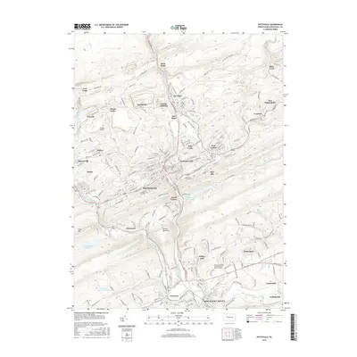
2016 Map of Pottsville
USGS Topo · Published 2016About this map
Pottsville and the Schuylkill Haven region anchor this detailed portrait of Pennsylvania’s anthracite coal country. The landscape is defined by the steep ridges of Sharp Mountain and Second Mountain, where the West Branch Schuylkill River and Mill Creek carve through the narrow valleys that have long dictated the area's transport and settlement patterns. Dense clusters of borough life are evident in St. Clair, Port Carbon, and Minersville, each marked by numerous parish churches and cemeteries like St Marys Ch and St Patricks Cem that speak to the ethnic heritage of the local mining communities.
Find a feature on this map
234 named features on this map. Tap any name to fly to it.
Don’t see what you’re looking for? This feature index may not catch every label — zoom into the map to look around manually.
Map Details
Editions of this 2016 Pottsville Map
This is the sole edition of this map. No revisions or reprints were ever made.
Other maps of this area

1889 · Catawissa
USGS Topo · 1:62,500

1889 · Pottsville
USGS Topo · 1:62,500

1891 · Pottsville
USGS Topo · 1:62,500

1892 · Catawissa
USGS Topo · 1:62,500

1892 · Mahanoy
USGS Topo · 1:62,500

1892 · Pine Grove
USGS Topo · 1:62,500

1893 · Mahanoy
USGS Topo · 1:62,500

1894 · Catawissa
USGS Topo · 1:62,500

1944 · Pottsville
USGS Topo · 1:24,000

1944 · Orwigsburg
USGS Topo · 1:24,000