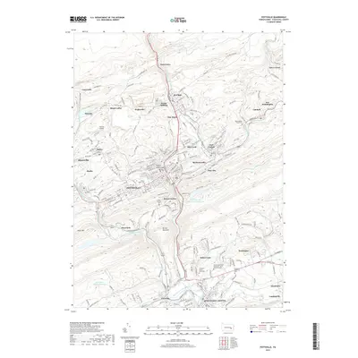
2019 Map of Pottsville
USGS Topo · Published 2019About this map
Pottsville and the surrounding anthracite coal country are defined by a landscape of ridge-and-valley terrain and tight industrial settlements. In the northern reaches, the legacy of mining is evident in places like East Mines and Coal Castle, where the steep slopes of Sharp Mountain and Second Mountain constrain the development of towns such as St. Clair and Minersville. The confluence of the West Branch Schuylkill River and the main Schuylkill River stem at Schuylkill Haven serves as a focal point for the region's transport network, which includes the Reading Blue Mountain and Northern Railroad. Significant local history is preserved in numerous memorial sites, including the Charles Baber Cem and Saint Patrick's Cem. From the urban center at Pottsville to the smaller boroughs like Port Carbon and Palo Alto, the map reveals a mature community built around the geography of the coal industry.
Find a feature on this map
210 named features on this map. Tap any name to fly to it.
Don’t see what you’re looking for? This feature index may not catch every label — zoom into the map to look around manually.
Map Details
Editions of this 2019 Pottsville Map
This is the sole edition of this map. No revisions or reprints were ever made.
Other maps of this area

1889 · Catawissa
USGS Topo · 1:62,500

1889 · Pottsville
USGS Topo · 1:62,500

1891 · Pottsville
USGS Topo · 1:62,500

1892 · Catawissa
USGS Topo · 1:62,500

1892 · Mahanoy
USGS Topo · 1:62,500

1892 · Pine Grove
USGS Topo · 1:62,500

1893 · Mahanoy
USGS Topo · 1:62,500

1894 · Catawissa
USGS Topo · 1:62,500

1944 · Pottsville
USGS Topo · 1:24,000

1944 · Orwigsburg
USGS Topo · 1:24,000