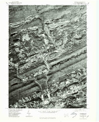
1976 Map of Pottsville
USGS Topo · Published 1979About this map
Pottsville anchors this aerial perspective, revealing the dense settlement patterns and industrial scars of the Pennsylvania anthracite coal region during the late 1970s. The sharp geological folds of the Appalachians are vividly clear, with the parallel ridges of Sharp Mountain and Second Mountain constricting urban growth to the narrow valleys. Along the Schuylkill River, the neighboring boroughs of Port Carbon and New Philadelphia follow the waterway and the historical corridors of regional transport.
Find a feature on this map
8 named features on this map. Tap any name to fly to it.
Don’t see what you’re looking for? This feature index may not catch every label — zoom into the map to look around manually.
Map Details
Editions of this 1976 Pottsville Map
This is the sole edition of this map. No revisions or reprints were ever made.
Other maps of this area

1889 · Catawissa
USGS Topo · 1:62,500

1889 · Pottsville
USGS Topo · 1:62,500

1891 · Pottsville
USGS Topo · 1:62,500

1892 · Catawissa
USGS Topo · 1:62,500

1892 · Mahanoy
USGS Topo · 1:62,500

1892 · Pine Grove
USGS Topo · 1:62,500

1893 · Mahanoy
USGS Topo · 1:62,500

1894 · Catawissa
USGS Topo · 1:62,500

1944 · Pottsville
USGS Topo · 1:24,000

1944 · Orwigsburg
USGS Topo · 1:24,000