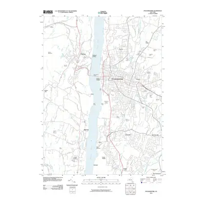
2010 Map of Poughkeepsie
USGS Topo · Published 2010About this map
Poughkeepsie dominates the eastern bank of the Hudson River, serving as a dense urban hub connected to the western shore by the Mid-Hudson Bridge. This 2010 survey illustrates the transition from the bustling city center and neighboring Arlington to the suburban and agricultural outskirts. The landscape is marked by long-standing institutions like Vassar Farm and the sprawling Poughkeepsie Rural Cemetery, alongside recreational spaces such as Vassar Golf Course.
Find a feature on this map
102 named features on this map. Tap any name to fly to it.
Don’t see what you’re looking for? This feature index may not catch every label — zoom into the map to look around manually.
Map Details
Editions of this 2010 Poughkeepsie Map
This is the sole edition of this map. No revisions or reprints were ever made.
Other maps of this area

1893 · Poughkeepsie
USGS Topo · 1:62,500

1894 · Poughkeepsie
USGS Topo · 1:62,500

1898 · Rhinebeck
USGS Topo · 1:62,500

1901 · Rosendale
USGS Topo · 1:62,500

1903 · Poughkeepsie
USGS Topo · 1:62,500

1903 · Newburg
USGS Topo · 1:62,500

1903 · Rosendale
USGS Topo · 1:62,500

1934 · Rhinebeck
USGS Topo · 1:48,000

1936 · Poughkeepsie
USGS Topo · 1:48,000

1939 · Rhinebeck
USGS Topo · 1:62,500