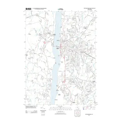
2013 Map of Poughkeepsie
USGS Topo · Published 2013About this map
The Hudson River serves as the central axis of this Hudson Valley landscape, dividing the urban and institutional corridors of the east bank from the orchards and mountains of the west. In the early 21st century, the east bank is defined by prominent institutions and residential clusters, including the Marist College Arboretum, Vassar Farm, and the suburban developments of Spackenkill and Arlington. The Poughkeepsie Railroad Bridge stands as a massive landmark spanning the water toward Highland Landing. To the west, the topography rises sharply at Illinois Mountain, where the land use shifts toward agriculture and nursery production at sites like Prospect Hill Orchards and Mountain Fresh Farms. This map documents a high density of historical burial sites, from the expansive Poughkeepsie Rural Cem to the Old Presbyterian Ground and Saint Peters Cem, providing a detailed record of the area's social and community geography.
Find a feature on this map
399 named features on this map. Tap any name to fly to it.
Don’t see what you’re looking for? This feature index may not catch every label — zoom into the map to look around manually.
Map Details
Editions of this 2013 Poughkeepsie Map
This is the sole edition of this map. No revisions or reprints were ever made.
Other maps of this area

1893 · Poughkeepsie
USGS Topo · 1:62,500

1894 · Poughkeepsie
USGS Topo · 1:62,500

1898 · Rhinebeck
USGS Topo · 1:62,500

1901 · Rosendale
USGS Topo · 1:62,500

1903 · Poughkeepsie
USGS Topo · 1:62,500

1903 · Newburg
USGS Topo · 1:62,500

1903 · Rosendale
USGS Topo · 1:62,500

1934 · Rhinebeck
USGS Topo · 1:48,000

1936 · Poughkeepsie
USGS Topo · 1:48,000

1939 · Rhinebeck
USGS Topo · 1:62,500