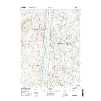
2016 Map of Poughkeepsie
USGS Topo · Published 2016About this map
The Hudson River serves as the central axis for this mid-2010s study of the historic riverfront, separating the urban density of Poughkeepsie from the fruit-growing landscapes of Highland and Milton in Ulster County. The map reveals a high concentration of educational and civic institutions, including the sprawling campuses of Vassar College, Marist College, and the Culinary Institute of America. In the city center, the Mid Hudson Bridge and East-West Arterial define the modern transit corridors, while the expansive Poughkeepsie Rural Cemetery and Saint Peters Cemetery provide significant touchstones for local genealogical research. Across the water, the terrain rises sharply toward Illinois Mountain and the Marlboro Mountains, where smaller hamlets like Oakes and Highland Landing maintain their river-oriented character near Blue Point and Sunfish Cove.
Find a feature on this map
70 named features on this map. Tap any name to fly to it.
Don’t see what you’re looking for? This feature index may not catch every label — zoom into the map to look around manually.
Map Details
Editions of this 2016 Poughkeepsie Map
This is the sole edition of this map. No revisions or reprints were ever made.
Other maps of this area

1893 · Poughkeepsie
USGS Topo · 1:62,500

1894 · Poughkeepsie
USGS Topo · 1:62,500

1898 · Rhinebeck
USGS Topo · 1:62,500

1901 · Rosendale
USGS Topo · 1:62,500

1903 · Poughkeepsie
USGS Topo · 1:62,500

1903 · Newburg
USGS Topo · 1:62,500

1903 · Rosendale
USGS Topo · 1:62,500

1934 · Rhinebeck
USGS Topo · 1:48,000

1936 · Poughkeepsie
USGS Topo · 1:48,000

1939 · Rhinebeck
USGS Topo · 1:62,500