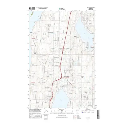
2017 Map of Poulsbo
USGS Topo · Published 2017About this map
Bangor Base and the surrounding coastal communities of the Great Peninsula are detailed in this 2017 survey, showing the modern interface between military installations and residential growth. The map centers on the corridor between Poulsbo and Silverdale, where the hydrology of the Puget Sound—including Dyes Inlet, Liberty Bay, and Hood Canal—dictates the layout of the landscape. Settlement patterns are dense around Scandia, Lemolo, and Pearson, while the interior remains marked by features like Island Lake and the drainage of Clear Cr. Genealogists will find several notable burial sites recorded, including the Silverdale Pioneer Cem and First Lutheran Church Cem. The map also captures specialized infrastructure such as the Apex Airpark and the intricate road network serving the naval base at Bangor, illustrating how the region's defense-driven economy and maritime geography have shaped Kitsap County.
Find a feature on this map
233 named features on this map. Tap any name to fly to it.
Don’t see what you’re looking for? This feature index may not catch every label — zoom into the map to look around manually.
Map Details
Editions of this 2017 Poulsbo Map
This is the sole edition of this map. No revisions or reprints were ever made.
Other maps of this area

1936 · Point Misery
USGS Topo · 1:62,500

1937 · Port Orchard
USGS Topo · 1:62,500

1937 · Port Gamble
USGS Topo · 1:62,500

1940 · Port Gamble
USGS Topo · 1:62,500

1940 · Point Misery
USGS Topo · 1:62,500

1940 · Quilcene
USGS Topo · 1:62,500

1953 · Seabeck
USGS Topo · 1:24,000

1953 · Poulsbo
USGS Topo · 1:24,000

1953 · Quilcene
USGS Topo · 1:24,000

1953 · Bremerton West
USGS Topo · 1:24,000