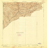
1926 Map of Pounding Mill
USGS Topo · Published 1926About this map
The McDowell and Tazewell County line defines the high ground in this 1920s survey of the central Appalachians. The rugged terrain is dominated by Stone Ridge and Big Creek, where small settlements and a dense network of country schools served the local population before mid-century consolidation. Communities like Hartwell and Sayersville are tucked into narrow valleys, connected by routes such as Valleycreek Rd. Education was decentralized at this time, evidenced by the scattered locations of the Bowman School, George Camp School, and the Rivermount School. Along the southwestern edge, the Norfolk and Western railroad follows the winding path of Dry Fork, facilitating the movement of resources through the corridor near Bandy and Harman. The map documents a landscape of steep hollows and family-named landmarks like Horsepen Cove and Bearwallow Knob at a time when mountain life was still deeply tied to these specific geographic drainages.
Find a feature on this map
38 named features on this map. Tap any name to fly to it.
Don’t see what you’re looking for? This feature index may not catch every label — zoom into the map to look around manually.
Map Details
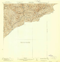
Editions of this 1926 Pounding Mill Map
2 editions found
Other maps of this area

1887 · Pocahontas
USGS Topo · 1:125,000

1889 · Wytheville
USGS Topo · 1:125,000

1891 · Tazewell
USGS Topo · 1:125,000

1891 · Pocahontas
USGS Topo · 1:125,000

1891 · Abingdon
USGS Topo · 1:125,000

1892 · Wytheville
USGS Topo · 1:125,000

1894 · Pocahontas
USGS Topo · 1:125,000

1894 · Abingdon
USGS Topo · 1:125,000

1895 · Tazewell
USGS Topo · 1:125,000

1895 · Pocahontas
USGS Topo · 1:125,000