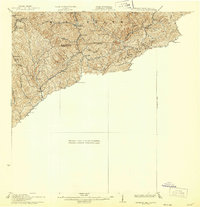
1926 Map of Pounding Mill
USGS Topo · Published 1926About this map
The rugged intersection of the McDowell Co Tazewell Co line and the state border defines this 1926 study of the Appalachian highlands. High peaks like Bearwallow Knob and the sprawling Stone Ridge dominate the landscape, while human settlement follows the narrow hollows carved by the Dry Fork and Big Creek. The Norfolk and Western RR winds through the southwestern corridor, connecting small mountain communities such as Bandy and Vandyke to the broader regional economy. Numerous rural educational sites, including the George Camp School and Rivermont School, are scattered across the terrain, illustrating the decentralized nature of early twentieth-century mountain life. The presence of the Hartwell Valleycreek PO near the state line serves as a focal point for the local community, while settlements like Sayersville and Squire mark the deep integration of residents into this dissected plateau.
Find a feature on this map
37 named features on this map. Tap any name to fly to it.
Don’t see what you’re looking for? This feature index may not catch every label — zoom into the map to look around manually.
Map Details
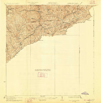
Editions of this 1926 Pounding Mill Map
2 editions found
Other maps of this area

1887 · Pocahontas
USGS Topo · 1:125,000

1889 · Wytheville
USGS Topo · 1:125,000

1891 · Tazewell
USGS Topo · 1:125,000

1891 · Pocahontas
USGS Topo · 1:125,000

1891 · Abingdon
USGS Topo · 1:125,000

1892 · Wytheville
USGS Topo · 1:125,000

1894 · Pocahontas
USGS Topo · 1:125,000

1894 · Abingdon
USGS Topo · 1:125,000

1895 · Tazewell
USGS Topo · 1:125,000

1895 · Pocahontas
USGS Topo · 1:125,000