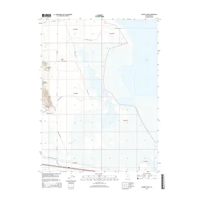
2014 Map of Poverty Point
USGS Topo · Published 2014About this map
The eastern reaches of the Great Salt Lake dominate the arid landscape of Tooele County in this 2014 survey. The terrain transitions from the salt-flats shoreline to the elevated topography of the Lakeside Mountains and landmarks such as Black Knoll and Dead Cow Point. A network of specialized access roads, including Stansbury Causeway Rd and the Western Pacific RR Access Rd, reflects the industrial and logistical infrastructure required to navigate this remote salt-basin environment. Localized geographical names like Poverty Point and the adjacent Poverty Flats Rd suggest a history of difficult passage or marginal utility in this saline desert. To the south, the presence of Greasewood Pond and I-80 Frontage Rd highlights the intersection of natural basins and the primary interstate corridor through the Great Basin.
Find a feature on this map
27 named features on this map. Tap any name to fly to it.
Don’t see what you’re looking for? This feature index may not catch every label — zoom into the map to look around manually.
Map Details
Editions of this 2014 Poverty Point Map
This is the sole edition of this map. No revisions or reprints were ever made.
Other maps of this area

1885 · Tooele Valley
USGS Topo · 1:250,000

1953 · Tooele
USGS Topo · 1:250,000

1955 · Timpie
USGS Topo · 1:62,500

1955 · Tooele
USGS Topo · 1:250,000

1968 · Poverty Point
USGS Topo · 1:24,000

1968 · Badger Island NW
USGS Topo · 1:24,000

1968 · Badger Island
USGS Topo · 1:24,000

1968 · Corral Canyon
USGS Topo · 1:24,000

1968 · Craner Peak
USGS Topo · 1:24,000

1973 · Delle
USGS Topo · 1:24,000