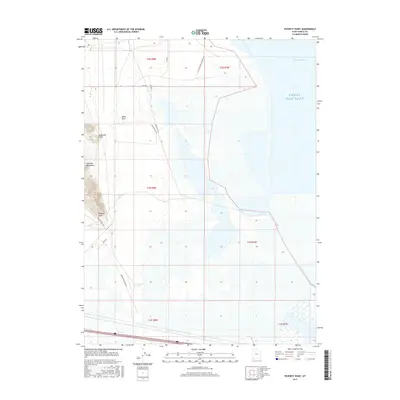
2017 Map of Poverty Point
USGS Topo · Published 2017About this map
Great Salt Lake dominates the eastern expanse of this Tooele County survey, where the waters of Stansbury Bay meet a landscape of salt flats and desert shorelines. The western edge is defined by the sharp rise of the Lakeside Mountains, a stark contrast to the low-lying wetlands and seasonal water bodies like Greasewood Pond that dot the interior. This 2017 edition by the U.S. Geological Survey documents a network of industrial and access roads including the W W Stansbury Causeway Rd and Poverty Point Rd, which navigate the unforgiving terrain between named landmarks like Dead Cow Point and Black Knoll. The map serves as a detailed record of the intersection between the massive saline lake and the high desert, providing clarity for those tracking physical changes in the shoreline or the remote road systems serving this part of the Great Basin.
Find a feature on this map
22 named features on this map. Tap any name to fly to it.
Don’t see what you’re looking for? This feature index may not catch every label — zoom into the map to look around manually.
Map Details
Editions of this 2017 Poverty Point Map
This is the sole edition of this map. No revisions or reprints were ever made.
Other maps of this area

1885 · Tooele Valley
USGS Topo · 1:250,000

1953 · Tooele
USGS Topo · 1:250,000

1955 · Timpie
USGS Topo · 1:62,500

1955 · Tooele
USGS Topo · 1:250,000

1968 · Poverty Point
USGS Topo · 1:24,000

1968 · Badger Island NW
USGS Topo · 1:24,000

1968 · Badger Island
USGS Topo · 1:24,000

1968 · Corral Canyon
USGS Topo · 1:24,000

1968 · Craner Peak
USGS Topo · 1:24,000

1973 · Delle
USGS Topo · 1:24,000