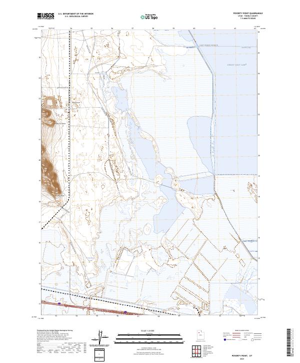
2023 Map of Poverty Point
USGS Topo · Published 2023About this map
Great Salt Lake dominates the eastern margin of this survey, where the waters of Stansbury Bay meet a landscape of salt flats and distinct landforms. The terrain is defined by named rises such as Black Knoll and the prominent Poverty Point, which overlooks a network of desert tracks. Transportation through this arid environment is limited to specific routes like the W West Stansbury Causeway Rd and Green Stick Rd, which navigate the shifting boundaries between dry land and seasonal water features. The map illustrates a stark geographic relationship between the massive salt lake and the isolated interior points like Dead Cow Point. Localized water sources, notably Greasewood Pond, provide rare breaks in the alkaline flats, offering a detailed look at the hydrology of the eastern Great Basin during the early twenty-first century.
Find a feature on this map
16 named features on this map. Tap any name to fly to it.
Don’t see what you’re looking for? This feature index may not catch every label — zoom into the map to look around manually.
Map Details
Editions of this 2023 Poverty Point Map
This is the sole edition of this map. No revisions or reprints were ever made.
Other maps of this area

1885 · Tooele Valley
USGS Topo · 1:250,000

1953 · Tooele
USGS Topo · 1:250,000

1955 · Timpie
USGS Topo · 1:62,500

1955 · Tooele
USGS Topo · 1:250,000

1968 · Poverty Point
USGS Topo · 1:24,000

1968 · Badger Island NW
USGS Topo · 1:24,000

1968 · Badger Island
USGS Topo · 1:24,000

1968 · Corral Canyon
USGS Topo · 1:24,000

1968 · Craner Peak
USGS Topo · 1:24,000

1973 · Delle
USGS Topo · 1:24,000