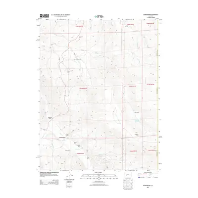
2013 Map of Powderhorn
USGS Topo · Published 2013About this map
Powderhorn and the surrounding high-country terrain of Gunnison County are defined by a network of creeks and isolated ranching operations. The settlement is positioned near the confluence of Powderhorn Cr and Cebolla Cr, a landscape where geothermal features like Cebolla Hot Springs provided unique landmarks for early inhabitants. To the north, the small community of Spencer sits among the complex drainage systems of Wolf Cr and Willow Cr, while landmarks like Ninemile Hill and Huntsman Mesa rise above the gulches. The presence of Youmans Ranch and Howard Ranch highlights the enduring pastoral character of this region, which remains largely rural and dominated by the natural topography of Iron Hill and the deep cuts of Wildcat Gulch and Milkranch Gulch. This map provides a detailed view of the infrastructure supporting these remote settlements, from county roads to water management at Soderquist Reservoir.
Find a feature on this map
44 named features on this map. Tap any name to fly to it.
Don’t see what you’re looking for? This feature index may not catch every label — zoom into the map to look around manually.
Map Details
Editions of this 2013 Powderhorn Map
This is the sole edition of this map. No revisions or reprints were ever made.
Other maps of this area

1908 · Uncompahgre
USGS Topo · 1:125,000

1911 · Uncompahgre
USGS Topo · 1:125,000

1954 · Iris NW
USGS Topo · 1:24,000

1954 · Iola
USGS Topo · 1:24,000

1954 · Cebolla
USGS Topo · 1:24,000

1954 · Gateview
USGS Topo · 1:24,000

1956 · Montrose
USGS Topo · 1:250,000

1959 · Montrose
USGS Topo · 1:250,000

1960 · Montrose
USGS Topo · 1:250,000

1962 · Rudolph Hill
USGS Topo · 1:24,000