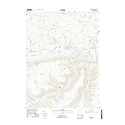
2016 Map of Powell
USGS Topo · Published 2016About this map
Towanda Creek carves a central valley through this part of Bradford County, serving as the primary corridor for settlements like Franklindale and Powell. The landscape is defined by the contrast between these fertile creek bottoms and the surrounding heights of Naglee Mtn and Lamoka Mtn. A significant concentration of small burial grounds, including the Willey Family Cem and Dodge Cem, suggests a long-standing pattern of localized family landholdings in the hills. To the south, the terrain becomes more isolated as it drops into Long Valley and the Deep Hollow drainage. The map preserves the names of numerous rural routes and family-named landmarks such as N Preacher's Brook Rd and Harris Rd, which provide valuable geographic context for tracing ancestral farmsteads and the early infrastructure of West Burlington Township.
Find a feature on this map
76 named features on this map. Tap any name to fly to it.
Don’t see what you’re looking for? This feature index may not catch every label — zoom into the map to look around manually.
Map Details
Editions of this 2016 Powell Map
This is the sole edition of this map. No revisions or reprints were ever made.
Other maps of this area

1923 · Towanda
USGS Topo · 1:62,500

1926 · Towanda
USGS Topo · 1:62,500

1939 · Sayre
USGS Topo · 1:62,500

1942 · Sayre
USGS Topo · 1:62,500

1943 · Towanda
USGS Topo · 1:62,500

1943 · Monroeton
USGS Topo · 1:62,500

1943 · Powell
USGS Topo · 1:62,500

1945 · Powell
USGS Topo · 1:62,500

1948 · Sayre
USGS Topo · 1:62,500

1954 · Williamsport
USGS Topo · 1:250,000
Featured Places
- West Burlington Township, PA
- Overton Township, PA
- Highland, Burlington Township
- Towanda Township, PA
- Franklindale, Franklin Township