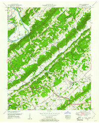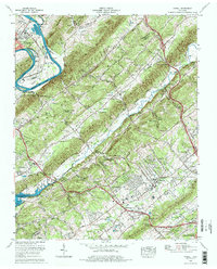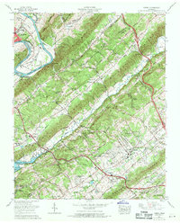
1968 Map of Powell
USGS Topo · Published 1971About this map
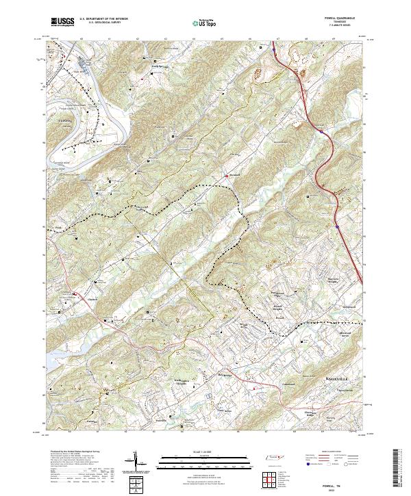
Parallel ridgelines of Pine Ridge, Copper Ridge, and Beaver Ridge dominate this topographic study of the Tennessee Valley north of Knoxville. The landscape is a mix of agricultural valleys and emerging suburban developments such as Broad Acres, Lakewood, and Washington Heights. The Clinch River and the waters of Melton Hill Lake define the western boundary, where the river winds through Dismal Gap. Genealogists will find a significant concentration of family-named landmarks and burial sites, including the Mabry Cem, Sartin Cem, and the notable Slave cem near Wolf Valley Creek. The rural social fabric is anchored by numerous country houses of worship like Lonesome Dove Church and Haven Chapel, while the Southern railroad line and U.S. 441 facilitate movement through the gaps toward Clinton.
Find a feature on this map
66 named features on this map. Tap any name to fly to it.
Don’t see what you’re looking for? This feature index may not catch every label — zoom into the map to look around manually.
Map Details
Editions of this 1968 Powell Map
This is the sole edition of this map. No revisions or reprints were ever made.
Historical Maps of Broadacres Through Time
4 maps found