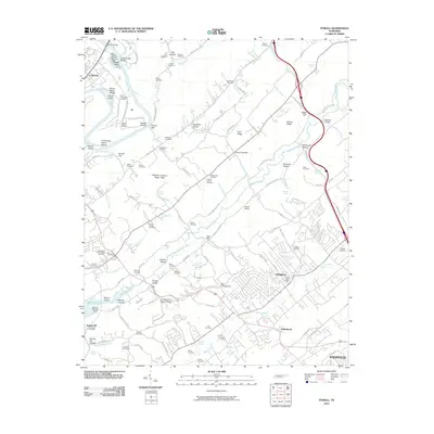
2022 Map of Powell
USGS Topo · Published 2022About this map
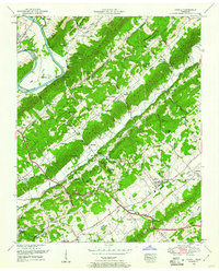
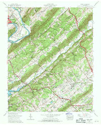
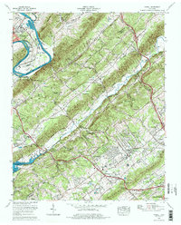
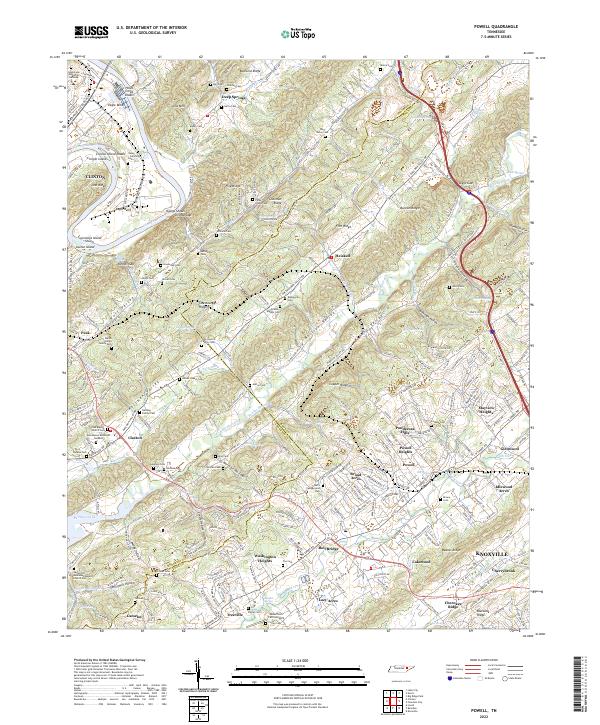
The Clinch River carves a deep horseshoe at Eagle Bend near Clinton, defining a landscape where industrial parks meet agricultural valleys. This 2022 survey captures the northern expansion of the Knoxville area, documenting the boundary between Anderson Co and Knox Co as it cuts through Bullrun Valley and across Copper Ridge. Small-scale aviation at Robertson Farm Airport and numerous family burying grounds, such as the Daniel Yarnell Family Cem and Kelsing Family Cem, reflect a transition from traditional rural homesteads to modern suburban developments like Ponderosa Hills and Broad Acres. The topography is dominated by parallel ridges, including Pine Ridge and Blackoak Ridge, which have historically funneled transportation and settlement patterns into the narrow corridors of Wolf Valley and Raccoon Valley.
Find a feature on this map
269 named features on this map. Tap any name to fly to it.
Don’t see what you’re looking for? This feature index may not catch every label — zoom into the map to look around manually.
Map Details
Editions of this 2022 Powell Map
This is the sole edition of this map. No revisions or reprints were ever made.
Historical Maps of Knoxville Through Time
8 maps found